


Country Club Voting District, Mohave County, Arizona
About
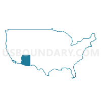
Outline

Summary
| Unique Area Identifier | 525069 |
| Name | Country Club Voting District |
| County | Mohave County |
| State | Arizona |
| Area (square miles) | 11.88 |
| Land Area (square miles) | 11.88 |
| Water Area (square miles) | 0.00 |
| % of Land Area | 100.00 |
| % of Water Area | 0.00 |
| Latitude of the Internal Point | 35.22908970 |
| Longtitude of the Internal Point | -114.07679250 |
Maps


Graphs
Select a template below for downloading or customizing gragh for Country Club Voting District, Mohave County, Arizona


Neighbors
Neighoring Voting District (by Name) Neighboring Voting District on the Map
- Beale Voting District, Mohave County, AZ
- Broadway Voting District, Mohave County, AZ
- Camelback Voting District, Mohave County, AZ
- Golden Valley Voting District, Mohave County, AZ
- Hilltop Voting District, Mohave County, AZ
- Mountainview Voting District, Mohave County, AZ
- North Kingman Voting District, Mohave County, AZ
- Southwest Kingman Voting District, Mohave County, AZ
- Zuni Voting District, Mohave County, AZ
Top 10 Neighboring County Subdivision (by Population) Neighboring County Subdivision on the Map
Top 10 Neighboring Place (by Population) Neighboring Place on the Map
Top 10 Neighboring Unified School District (by Population) Neighboring Unified School District on the Map
Top 10 Neighboring State Legislative District Lower Chamber (by Population) Neighboring State Legislative District Lower Chamber on the Map
Top 10 Neighboring State Legislative District Upper Chamber (by Population) Neighboring State Legislative District Upper Chamber on the Map
Top 10 Neighboring 111th Congressional District (by Population) Neighboring 111th Congressional District on the Map
Top 10 Neighboring Census Tract (by Population) Neighboring Census Tract on the Map
- Census Tract 9506, Mohave County, AZ (9,029)
- Census Tract 9539, Mohave County, AZ (6,696)
- Census Tract 9538, Mohave County, AZ (6,345)
- Census Tract 9549, Mohave County, AZ (3,796)
- Census Tract 9536.02, Mohave County, AZ (2,647)